1. Overview of Lao Than Peak - "The Roof of Y Ty" attracts trekkers
1.1. Geographical location and specific coordinates
Lao Than Peak belongs to the land of Y Ty, Bat Xat, Lao Cai. This is the highest point in Y Ty, belonging to the Northwest mountain range. Surrounding Lao Than are layers of terraced fields that change color with the seasons, along with villages of the Mong and Ha Nhi people appearing in the thin mist, creating a space full of highland character.
This location is particularly convenient for combining with a trip to explore Sa Pa, as tourists only need to travel a short distance further to enter the more pristine land of Y Ty, less impacted by tourism activities compared to the central Sa Pa region.
Lao Than also offers opportunities to learn about the unique culture of the local ethnic groups, from the earth-walled houses of the Ha Nhi people, the simple lifestyle of the Mong people, to the distinctive highland markets. It is this blend of majestic nature and diverse cultural life that makes Lao Than a captivating destination for those who love trekking and exploring mountain cultures.
1.2. Altitude and ranking among Vietnam's mountains
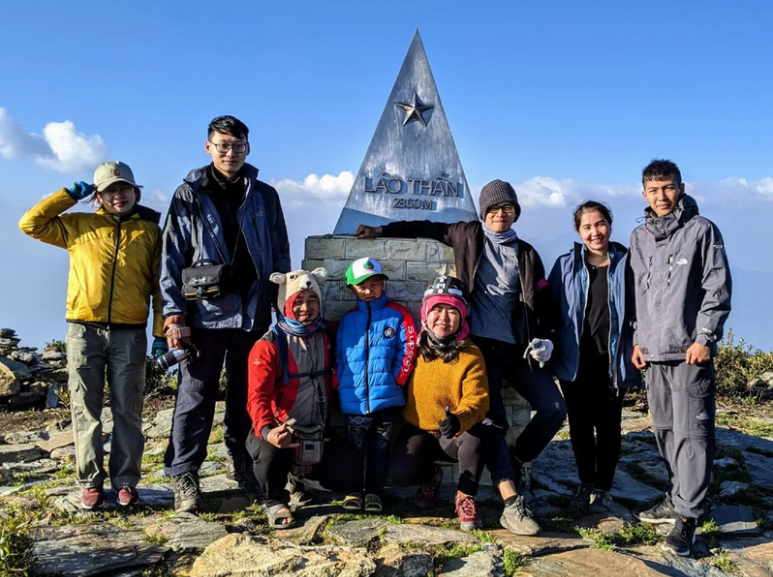
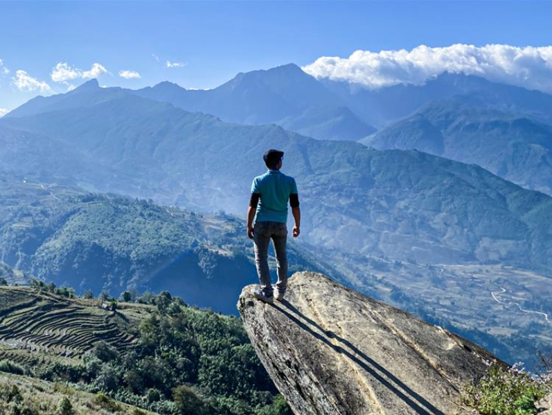
With an altitude of 2,862 m, Lao Than is among the highest mountains in Vietnam, standing out amidst the majestic Hoang Lien Son range. This altitude not only provides an advantage in terms of views but also earns the mountain the title "Roof of Y Ty". Compared to the general level of mountains in the region, Lao Than is far superior, becoming an easily recognizable natural landmark and particularly attractive to trekkers.
Lao Than is among the highest mountains in Vietnam. (Source: Collected)
Reaching nearly 2.9 km in altitude, Lao Than offers ideal conditions for viewing the dense sea of clouds, which has become its signature. Thanks to its high, open, and isolated terrain, clouds often gather around its slopes and valleys, creating layers as fluffy as giant white silk sheets.
1.3. Factors Contributing to the Special Allure of Lao Than Peak
Lao Than Peak combines three elements beloved by trekkers: an ideal cloud-hunting space, a manageable trekking route, and opportunities to learn about rich local culture. Lao Than is also likened to the “roof of Y Ty” due to its expansive views and rare pristine landscape. The terrain is mainly gentle grassy hills, without too many cliffs or steep slopes, making it an ideal trekking route even for beginners.
The journey to conquer Lao Than is also attractive due to many outstanding check-in points. Mo Dong Doi is where groups of friends often stop for group photos against the vast sky. Meanwhile, Mo Tien Ong Cau Ca (also known as Mo Luoi Quy) is famous for impressive photos that create the feeling of “fishing in the sky amidst clouds”.
All these elements combine to create a Lao Than that is both accessible and breathtakingly beautiful. It is not just a simple trekking spot, but an experience of “touching the clouds,” a journey where visitors can find a sense of freedom and tranquility amidst nature. For those who love exploration and cloud hunting, Lao Than is deservedly one of the most beautiful destinations in Y Ty and a route worth trying at least once.
2. Special Trekking Experiences of Tourists
2.1. Assessment of Difficulty and Challenges
The route to Lao Than Peak is rated as moderately difficult, quite suitable for those who have basic mountain climbing experience. However, for people who are less active or are trying a high altitude for the first time, the distance of about 12 km to 15 km for the round trip, taking 8 to 10 hours, is still a significant challenge.
Especially, the final steep ascent to the summit requires many people to stop and rest continuously, but it is precisely these arduous moments that make the sense of accomplishment more complete. Some trekkers recount having to rest every 100 meters in the final section, but all fatigue vanished when they gazed at the sea of clouds below.
2.2. Emotions After Successfully Conquering Lao Than Peak
The moment of reaching Lao Than Peak is when all fatigue suddenly disappears, leaving only overwhelming joy, pride, and a lightness as if one has overcome oneself. After hours of climbing steep slopes, passing through mist and mountains, standing on the “roof of Y Ty,” looking at the sea of clouds below, everyone clearly feels the reward deserved for the challenging journey.
For many tourists, the feeling of victory after setting foot on Lao Than Peak has become a strong motivation, urging them to continue venturing on new, longer, higher, and more emotional trekking routes.
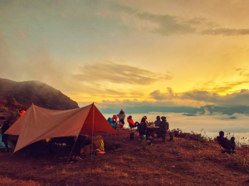
2.3. Scenery from the 2,862m Summit
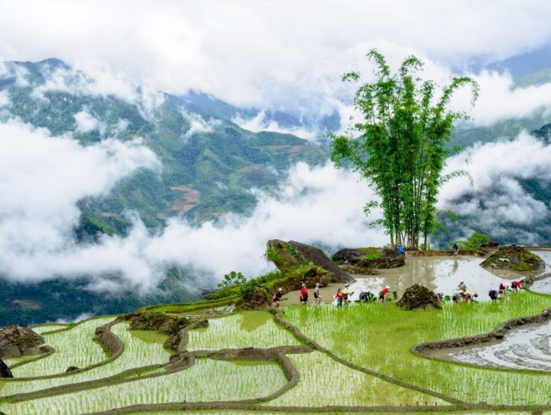
From an altitude of 2,862 m, Lao Than Peak reveals a spectacular panoramic view. In the distance, the majestic Nhu Co San range stands firm, and below are the fluffy white seas of clouds. The golden terraced fields of the Ha Nhi ethnic group and small villages, appearing and disappearing in the sea of clouds, create a vibrant Northwestern landscape.
Lao Than Peak opens up a spectacular panoramic view. (Source: Collected)
When the sky is clear, you can clearly see every detail of Y Ty valley, the winding rice terraces along the mountainside, and the faint smoke from distant stilt houses. Especially, the moments of sunrise and sunset here are always a creative inspiration for impressive photography works.
3. How to get to Lao Than Peak
3.1. Traveling from Hanoi to Y Ty (Lao Cai)
The journey to conquer Lao Than Peak usually starts from Hanoi, then moves to Sa Pa and continues to Y Ty commune, the starting point for trekking. Depending on your travel needs, you can choose to travel by bus, limousine, or self-drive for more flexibility in your schedule.
From Hanoi to Sa Pa You start from the center of Hanoi, pass through Nhat Tan Bridge and follow Vo Nguyen Giap road to the Noi Bai - Lao Cai expressway. This modern expressway shortens the travel time to only about 5 - 6 hours. Upon reaching the intersection with National Highway 4D, turn left and continue along 4D - Dien Bien Phu - Ngu Chi Son road to enter Sa Pa center.
Sleeper buses or limousines from My Dinh, Giap Bat, Gia Lam bus stations are also very popular choices. Most companies have evening departures, allowing you to arrive in Sa Pa early in the morning, saving time and conserving energy for the climb.
From Sa Pa to Y Ty From the center of Sa Pa, continue along National Highway 4D, then turn into Road 155. When you reach the intersection of Road 155 and Road 158, turn into Road 158 and go straight to Y Ty commune, the starting point of the Lao Thẩn trekking route.
The Sa Pa - Y Ty route features many winding mountain passes and majestic mountain scenery, especially beautiful in the early morning when clouds drift along the mountainside. This is also an ideal section for you to stop for check-ins or a light rest before officially starting the climb.
3.2. Traveling from Y Ty commune to the foot of Lao Than Peak
In the center of Y Ty, you should rent a local motorbike to get to Fin Ho village, where the trekking to Lao Than Peak begins. The last 10 km stretch goes through small, steep dirt paths and requires good control of the vehicle on complex terrain. Near the starting point, there are always safe parking spots, supported by porters or homestays.
For tourists starting from Ho Chi Minh City, Da Nang, or the Central provinces, the most convenient option is to fly to Hanoi and then continue the journey by road to Sa Pa and Y Ty. This mode of travel helps shorten the time, conserve energy, and ensure the Lao Thẩn trekking itinerary is more complete.
4. Lao Than Peak Trekking Itinerary
4.1. Overview of the trip itinerary
A day trip to conquer Lao Than Peak can start early in the morning from Lao Cai city. After about 3 hours of travel, the group will reach Fin Ho village, meet the porter, park the vehicle, and prepare essential items. Starting early helps you make the most of daylight and avoid unpredictable weather changes.
According to the itinerary, the group will start climbing at 08:30 AM, with a lunch break from 12 PM to 1 PM at a flat spot under the shade of trees. The entire journey is targeted to be completed before 5 PM for safety. However, many groups choose a 2-day, 1-night itinerary to have more time to enjoy the sunrise, sunset, and rest adequately.
4.2. Description of the trekking route
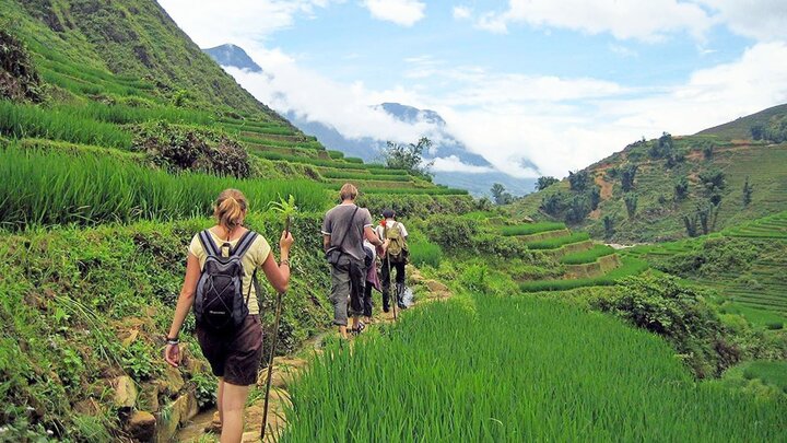
The journey to conquer Lao Than is about 7 - 8 km for the ascent, with constantly changing terrain, creating an interesting experience for both novice trekkers and those familiar with the mountains. The entire route can be divided into three main sections, each with its own character and increasing challenge with altitude.
Hành trình chinh phục Lảo Thẩn dài khoảng 7 - 8 km. (Nguồn: Sưu tầm)
• Đoạn 1: Từ thôn Phìn Hồ - khởi động nhẹ nhàng Đoạn đầu xuất phát từ thôn Phìn Hồ khá “dễ thở”, chủ yếu là đường đất rộng, dốc nhẹ, băng qua ruộng nương và những đồi cỏ xanh mát. Đây là quãng đường lý tưởng để làm nóng cơ thể, làm quen với nhịp thở và chuẩn bị sức lực cho những thử thách phía trước.
• Đoạn 2: Khu vực “cổng trời” - càng lên cao càng thử thách Tiếp tục tiến sâu vào núi, đường bắt đầu hẹp dần và dốc hơn, men theo các lối mòn do người dân tạo nên khi đi nương. Đến gần khu vực “cổng trời” - điểm đèo có tầm nhìn ôm trọn thung lũng, bạn sẽ gặp những đoạn rừng thưa, bụi rậm và đôi khi là suối nhỏ tùy thời điểm trong năm. Đây là cung đường khiến nhiều trekker thích thú bởi sự hoang sơ và tầm nhìn ngày càng mở rộng ra núi non trùng điệp.
• Đoạn 3: Từ thung lũng lên đỉnh - chặng bứt tốc cuối cùng Chặng nước rút lên đỉnh Lảo Thẩn là đoạn dốc nhất, đòi hỏi thể lực và sự kiên trì. Nhưng mỗi mét độ cao tăng lên, cảnh sắc lại trở nên kỳ vĩ hơn: mây bắt đầu tràn qua các sườn núi, gió mạnh hơn, không gian thoáng đãng và tầm nhìn rộng. Đây cũng là lúc du khách cảm nhận rõ ràng cảm giác chinh phục, từng bước tiến gần tới khoảnh khắc đặt chân lên “nóc nhà Y Tý”.
4.3. Vai trò hỗ trợ của porter địa phương
Porter địa phương là “người bạn đồng hành thầm lặng” nhưng vô cùng quan trọng. Am hiểu từng đoạn dốc, từng lối mòn và cả những biến chuyển thất thường của thời tiết vùng cao, họ đảm nhiệm vai trò dẫn đường an toàn cho cả đoàn, giúp du khách yên tâm trải nghiệm.
Không chỉ mang theo nước uống, đồ ăn và các vật dụng hỗ trợ cần thiết, porter còn theo sát nhịp độ của từng thành viên để điều chỉnh tốc độ và lựa chọn những tuyến đi phù hợp với thể lực của đoàn. Kinh nghiệm nhiều năm bám núi giúp họ dễ dàng nhận biết khi nào nên dừng nghỉ, khi nào nên tăng tốc để kịp thời gian lên đỉnh.
Một điểm cộng thú vị là sự chu đáo, linh hoạt của porter. Ở những đoạn dốc nguy hiểm, họ biết cách nhanh tay hỗ trợ, giúp du khách giữ thăng bằng tốt hơn - đặc biệt hữu ích với những người lần đầu trekking.
Không chỉ vậy, porters luôn biết chọn chính xác góc đẹp nhất ở mỏm đá, cổng trời hay thung lũng mây, lưu lại cho bạn những khung hình ấn tượng nhất của cả hành trình.
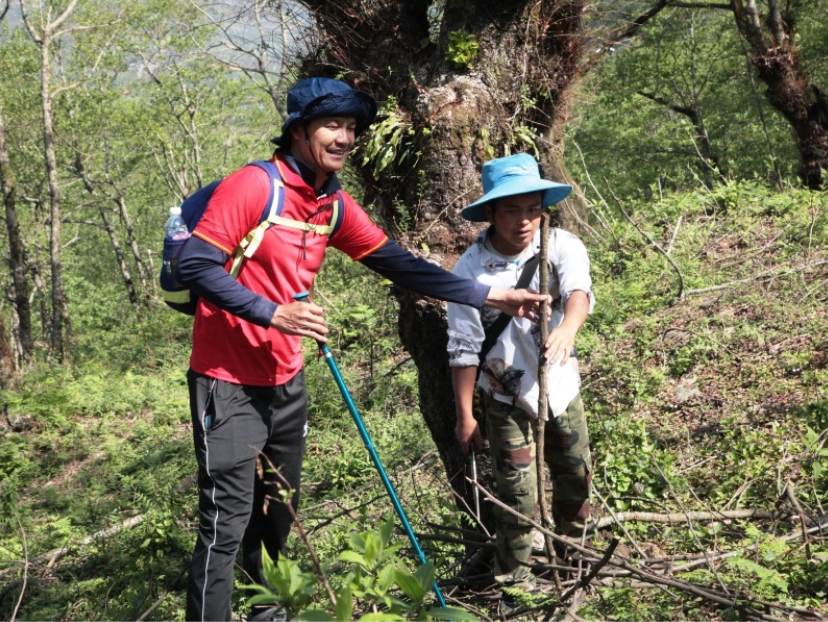
Local porters are extremely important "companions". (Source: Collected)
Thanks to the dedicated and experienced support of the porters, the journey to conquer Lao Than becomes easier and more complete, allowing each tourist to truly enjoy the beauty of the Northwest mountains and forests instead of worrying about the path or their luggage.
5. Special experiences at the summit of Lao Than mountain
5.1. Diverse natural scenery along the route
The route to the summit of Lao Than mountain is like a miniature natural museum of the Northwest. Right from the foot of the mountain, you will pass through golden terraced fields during the ripe rice season, lush green when planted, or flooded. Interspersed are sparse forests, moss-covered rocks characteristic of the mountain scenery.
As you ascend, the landscape gradually transitions to pine forests, bushes, and wild grass. Peeking out below the mountain are Ha Nhi and Mong villages with wisps of kitchen smoke gently spreading in the morning, creating a peaceful highland scene. The diversity of scenery makes every kilometer of the trekking route a new visual experience.
5.2. Unique natural check-in spots
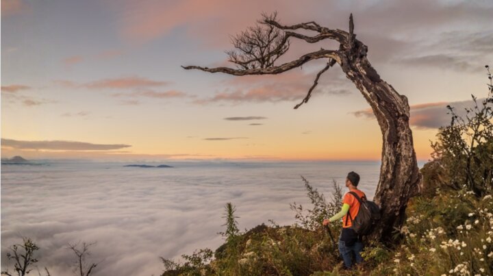
Lao Than mountain summit is nổi bật with many natural photo spots favored by the trekking community. The "fishing rock" is where tourists enjoy posing as if fishing amidst a sea of clouds, with the majestic Nhìu Cồ San mountain in the background. Midway through the journey, the "heaven's gate" is an ideal stop to gaze down at the valley with swirling white clouds.
When the mist descends in the early morning, the "cloud valley" transforms into a vast white sea of clouds, like a fairy tale. Some sparse forest sections allow light to penetrate, creating very striking effects, suitable for artistic photos. Near the resting hut, there are also large trees with unique shapes, which young people enjoy photographing to mark their trip.
5.3. Comprehensive sensory experience at high altitude
At an altitude of nearly 2,900 meters, Lao Than mountain summit offers an experience of perceiving the scenery with all senses. The brilliant sunlight in the early morning or late afternoon casts a warm golden hue over the landscape, making every photo look natural and captivating without much editing.
The scene at this moment makes everyone silent: a vast white sea of clouds rolls like a soft, floating stream, sometimes thick, sometimes thin, sometimes drifting away and then gathering again among the valleys. High above, the pale golden sunlight covers the mountain peaks, creating a scene that is both majestic and poetic, making everyone want to linger as long as possible to enjoy it.
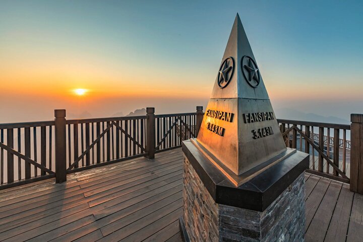
This scenery reminds many tourists visiting Sa Pa of the feeling of standing before the majestic clouds and sky at Fansipan peak - the "Roof of Indochina", where Sun World Fansipan Legend preserves and develops the unique ecological values of the Northwest region through a series of fun and entertainment tourism activities.
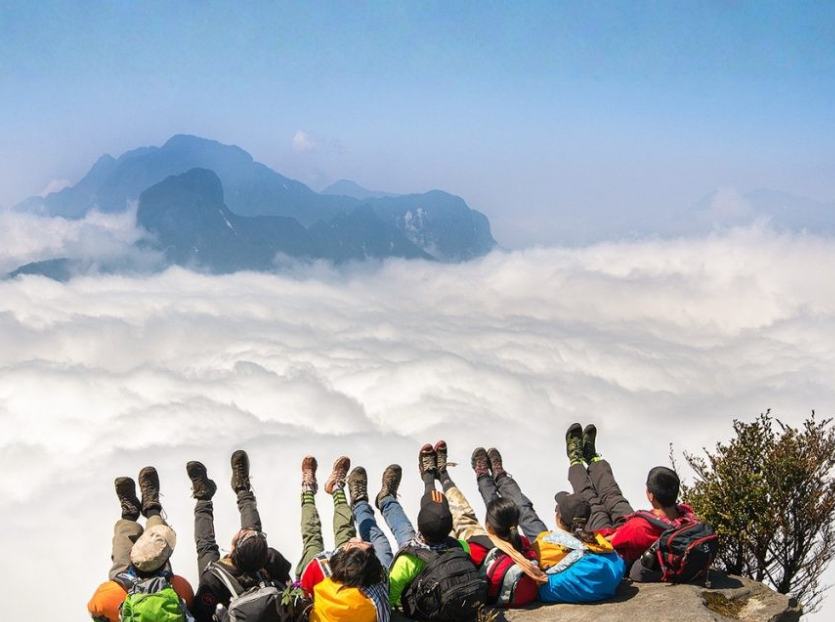
Lao Than Mountain Peak stands out with many natural photo spots favored by the trekking community. (Source: Collected)
After cloud hunting, the whole group started descending to the resting hut to pack up. The descent took about 3 hours, gentler but still requiring focus on steep sections. Around noon, the group returned to town, rested, ate, and officially concluded the trekking trip to conquer the "roof of Y Ty" completely and emotionally.
6. Practical experience when conquering Lao Than Mountain Peak
6.1. Summary of "Do's" and "Don'ts"
| Things to do | Things to avoid |
| Train physically 1-2 weeks prior by walking, climbing stairs, light jogging | Be complacent about health, climb when tired or with underlying conditions |
| Always move with the group, stick closely to experienced porters | Wander off from the group, turn onto unfamiliar trails, or climb to dangerous spots |
| Bring sufficient water, energy-boosting snacks like cakes, candies, nuts | Carry too many bulky, unnecessary items |
| Wear multiple layers for easy adjustment to hot and cold weather | Wear overly thin, water-absorbent clothing or shoes unsuitable for the terrain |
| Use specialized trekking shoes or shoes with good grip | Wear new shoes not yet broken in, or slippers, smooth-soled sneakers |
| Bring a raincoat, waterproof jacket, and warm clothing | Ignore checking the weather forecast before the trip |
| Collect personal trash, respect nature | Litter along the way, break branches, or carve names on rocks |
| Contact porters in advance to book services and ask for details | Unilaterally change the itinerary without group consensus |
6.2. Suitable trekking attire and equipment
Proper preparation of clothing is key to successfully conquering Lao Than Mountain Peak. Sweat-wicking shirts, trekking pants or stretchy leggings will allow you to move comfortably on steep terrain. Especially, you should bring a windbreaker and a thin warm jacket for early mornings and late evenings when the temperature can drop below 15 degrees Celsius.
Specialized trekking shoes or running shoes with good grip and ankle support are essential for the journey. A lightweight, well-fitting backpack is needed to carry items for a 1-day to 2-day trip. Trekking poles help reduce pressure on the knees when descending, and a headlamp will be very useful if you plan to move in the dark to catch the sunrise.
6.3. Weather response and environmental protection
Mountain weather changes rapidly, so check the forecast 2 to 3 days in advance and be prepared to adjust your schedule if there is heavy rain, thick fog, or strong winds. When conditions are unfavorable, following the porter's guidance and pausing or turning back is the safest option.
Visitors should note to update the weather forecast several days in advance when deciding to ascend the mountain. (Source: Collected)
Preserving the natural environment of Lao Than mountain peak is everyone's responsibility. Please take all your personal trash with you, including water bottles, packaging, and tissues, leaving no trace on the trail. Minimize impact on plants, do not cut or light fires arbitrarily to preserve the pristine beauty of this place.
6.4. Optimal Luggage Checklist
The principle of "light yet sufficient" should always be prioritized when preparing luggage for Lao Than mountain peak. For clothing, you only need 1 to 2 sets of trekking outfits, a warm jacket, and a waterproof jacket. For equipment, specialized shoes, trekking poles, a moderately sized backpack, a compact flashlight, and a raincoat are mandatory.
Essential personal items such as a small towel, wet wipes, common cold medicine, a power bank, and a trash bag should be fully prepared. For food and water, divide them into small bottles for easy carrying and gradual consumption. Additionally, have energy bars, biscuits, candies, or nuts to quickly replenish energy when needed.
Lao Than mountain peak not only offers a memorable trekking experience but also opens a door to connect you more closely with the culture of the Northwest highlands. The majestic sea of clouds, a manageable trail, and unforgettable memories with the local people will make the trip a highlight in your journey to explore Vietnam's nature. Plan, prepare thoroughly, and start your journey to conquer the "Roof of Y Ty" today!